Introduction to Wayfinding Design
Expert-defined terms from the Professional Certificate in Wayfinding Design course at London School of Business and Administration. Free to read, free to share, paired with a professional course.
Introduction to Wayfinding Design #
Introduction to Wayfinding Design
In the course "Professional Certificate in Wayfinding Design," students will lea… #
They will also explore case studies and real-world examples to understand how wayfinding design impacts people's navigation experience in various environments.
A #
A
Accessibility #
Accessibility
Accessibility refers to the design of environments, products, and services that… #
In wayfinding design, accessibility is crucial to ensure that navigation systems are inclusive and easy to use for everyone, including people with visual impairments, mobility issues, or cognitive disabilities.
Example #
Providing tactile maps and braille signage in a public building improves accessibility for people with visual impairments.
Architectural Signage #
Architectural Signage
Architectural signage refers to signage elements that are integrated into the ar… #
These signs are designed to complement the overall design aesthetic of the environment while providing wayfinding information to users.
Example #
A museum may use architectural signage to guide visitors through different galleries while maintaining a cohesive visual identity.
B #
B
Branding #
Branding
Branding is the process of creating a unique identity for a product, service, or… #
In wayfinding design, branding elements are often incorporated into signage and wayfinding systems to reinforce the organization's brand and create a cohesive user experience.
Example #
A hotel chain may use its brand colors and logo on signage throughout its properties to maintain brand consistency and enhance guest experience.
Color Contrast #
Color Contrast
Color contrast refers to the difference in brightness or hue between two colors #
In wayfinding design, color contrast is important for ensuring that text and graphics on signage are legible and easy to read, especially for people with visual impairments or color blindness.
Example #
Using high-contrast colors like black and white on signage improves readability and visibility in low-light conditions.
C #
C
Cartographic Design #
Cartographic Design
Cartographic design is the art and science of creating maps that are visually ap… #
In wayfinding design, cartographic design is used to create maps that help people navigate complex environments and understand spatial relationships.
Example #
A theme park may use cartographic design to create a map that shows the locations of rides, attractions, and facilities for visitors.
Consistency #
Consistency
Consistency in wayfinding design refers to the use of uniform visual elements, m… #
Consistent design helps users understand and predict how to navigate an environment, reducing confusion and improving user experience.
Example #
Maintaining consistent signage design and placement in a hospital helps patients and visitors navigate the facility more easily.
D #
D
Destination Code #
Destination Code
A destination code is a unique identifier assigned to a specific location or poi… #
Destination codes are used to label and categorize destinations, making it easier for users to search for and navigate to their desired locations.
Example #
A shopping mall may assign destination codes to different stores and amenities to help visitors find their way around the mall.
Dynamic Signage #
Dynamic Signage
Dynamic signage refers to digital signs that can change their content in real #
time based on factors such as user input, environmental conditions, or time of day. Dynamic signage is often used in wayfinding systems to provide up-to-date information and personalized directions to users.
Example #
An airport may use dynamic signage to display flight information, gate changes, and security wait times to passengers.
E #
E
Environmental Graphics #
Environmental Graphics
Environmental graphics are visual elements, such as signage, wayfinding systems,… #
In wayfinding design, environmental graphics are used to guide people through spaces and create a sense of place.
Example #
A university campus may use environmental graphics to display campus maps, building directories, and event information for students and visitors.
Experience Design #
Experience Design
Experience design is the process of creating meaningful and memorable interactio… #
In wayfinding design, experience design focuses on designing navigation systems that engage users, anticipate their needs, and create positive experiences as they move through a space.
Example #
A theme park may use experience design principles to create interactive wayfinding kiosks that entertain and inform visitors as they navigate the park.
F #
F
Font Legibility #
Font Legibility
Font legibility refers to the readability of text on signage, maps, and wayfindi… #
In wayfinding design, choosing legible fonts that are easy to read at a glance is essential for ensuring that users can quickly and accurately interpret navigation information.
Example #
Using a sans-serif font with ample spacing between letters improves font legibility on signage viewed from a distance.
Functional Zoning #
Functional Zoning
Functional zoning is the practice of organizing spaces into distinct zones or ar… #
In wayfinding design, functional zoning helps users understand the layout of a space and navigate to specific destinations within each zone.
Example #
A shopping mall may use functional zoning to group stores, restaurants, and entertainment venues into different areas for easier navigation.
G #
G
Graphic Symbols #
Graphic Symbols
Graphic symbols are visual icons or representations that convey information or i… #
In wayfinding design, graphic symbols are used on signage and maps to communicate directions, locations, services, and amenities in a universally understood manner.
Example #
Using a graphic symbol of a restroom on signage helps people easily identify the location of restroom facilities in a public space.
Grid System #
Grid System
A grid system is a layout framework that organizes content, graphics, and inform… #
In wayfinding design, grid systems are used to align and arrange signage elements, maps, and directions in a clear and consistent manner.
Example #
A wayfinding map may use a grid system to organize different sections, landmarks, and pathways for easy navigation.
H #
H
Human #
Centered Design
Human #
centered design is an approach to design that focuses on understanding the needs, behaviors, and preferences of users to create products, services, and experiences that meet their needs effectively. In wayfinding design, human-centered design principles are used to develop navigation systems that are intuitive, user-friendly, and accessible to all users.
Example #
Conducting user research and usability testing helps designers create human-centered wayfinding solutions that address users' navigation challenges and preferences.
Hierarchy of Information #
Hierarchy of Information
Hierarchy of information refers to the organization of content based on its impo… #
In wayfinding design, establishing a clear hierarchy of information helps users prioritize and process navigation instructions, directions, and points of interest efficiently.
Example #
Using different font sizes, colors, and placement to differentiate between main paths, landmarks, and secondary destinations in a wayfinding system creates a clear hierarchy of information.
I #
I
Iconography #
Iconography
Iconography is the practice of designing and using visual symbols, icons, and im… #
In wayfinding design, iconography is used to communicate information quickly and effectively, especially for users who may not speak the language or have literacy challenges.
Example #
Using a house icon to represent a residential area on a wayfinding map helps users identify the location of homes and neighborhoods.
Information Architecture #
Information Architecture
Information architecture is the organization and structure of information within… #
In wayfinding design, information architecture focuses on arranging navigation cues, signage, maps, and directions in a logical and intuitive manner for users.
Example #
Grouping similar destinations, services, or amenities together on a wayfinding map based on their proximity and function improves the information architecture of the map.
J #
J
Journey Mapping #
Journey Mapping
Journey mapping is a research and design tool that visualizes the steps, interac… #
In wayfinding design, journey mapping helps designers understand users' navigation processes, pain points, and preferences to improve wayfinding solutions.
Example #
Creating a journey map of a visitor's experience in a museum helps identify opportunities to enhance wayfinding and visitor engagement throughout the museum.
K #
K
Kiosk Design #
Kiosk Design
Kiosk design involves the creation of interactive touch #
screen displays or information terminals that provide users with navigation assistance, directions, and information. In wayfinding design, kiosks are used in public spaces, transportation hubs, and large facilities to help users find their way and access relevant information.
Example #
Installing interactive kiosks in a shopping mall allows visitors to search for stores, restaurants, and services and receive directions to their desired destinations.
L #
L
Legibility #
Legibility
Legibility refers to the ease with which text can be read and understood #
In wayfinding design, legibility is essential for ensuring that signage, maps, and directions are clear, readable, and accessible to users of all ages and abilities.
Example #
Increasing the size of text on directional signage and using high-contrast colors improves legibility for users navigating a busy airport terminal.
Location #
based Services
Location #
based services (LBS) are digital services that use geographic information, GPS technology, and mobile devices to provide users with location-specific information, directions, and notifications. In wayfinding design, location-based services enhance navigation experiences by delivering personalized and context-aware guidance to users.
Example #
Using a mobile app that offers location-based services, visitors to a museum can receive notifications about nearby exhibits, events, and amenities as they explore the museum.
M #
M
Modular Design #
Modular Design
Modular design is an approach to design that involves creating components or mod… #
In wayfinding design, modular design allows designers to create flexible signage systems that can adapt to different environments and user needs.
Example #
Designing a modular signage system for a university campus allows for easy updates and changes to signage as new buildings, departments, or services are added.
Example #
Using a mobile navigation app, tourists can explore a city, discover points of interest, and receive turn-by-turn directions to popular attractions.
N #
N
Example #
Developing a navigation design for a hospital includes mapping out routes to different departments, providing clear signage, and creating digital wayfinding tools for patients and visitors.
Example #
A shopping mall may use a navigation code system to assign unique identifiers to stores, restrooms, and parking areas for easy reference on signage and maps.
O #
O
Orientation Map #
Orientation Map
An orientation map is a large #
scale map displayed at key points in a space or environment to help users understand their current location, nearby landmarks, and available routes. In wayfinding design, orientation maps provide users with a visual overview of the space and help them orient themselves before proceeding to their destination.
Example #
Installing an orientation map at the entrance of a theme park helps visitors plan their route, locate attractions, and navigate the park efficiently.
Outdoor Wayfinding #
Outdoor Wayfinding
Example #
Installing directional signs, maps, and landmarks along hiking trails in a national park improves outdoor wayfinding for visitors and hikers.
P #
P
Pathfinding Algorithm #
Pathfinding Algorithm
A pathfinding algorithm is a computational method used to determine the shortest… #
In wayfinding design, pathfinding algorithms are used in digital navigation systems to calculate optimal routes for users based on factors such as distance, time, and obstacles.
Example #
Using a pathfinding algorithm in a mobile navigation app helps users find the quickest route to their destination, avoiding traffic and congestion.
Point of Interest (POI) #
Point of Interest (POI)
A point of interest (POI) is a specific location or attraction that may be of in… #
In wayfinding design, points of interest are identified and labeled on signage, maps, and digital navigation systems to help users discover and navigate to these destinations.
Example #
A wayfinding map of a city may include points of interest like museums, restaurants, and historical sites to help tourists explore the area.
Q #
Q
QR Code #
QR Code
A QR code is a two #
dimensional barcode that can be scanned using a smartphone or QR code reader to access information, websites, or digital content. In wayfinding design, QR codes are used on signage, maps, and printed materials to provide users with additional details, directions, or interactive features.
Example #
Placing QR codes on directional signs in a park allows visitors to scan the code and access a digital map with walking trails, points of interest, and park amenities.
Quick Response #
Quick Response
Quick response (QR) refers to the speed and efficiency with which users can acce… #
In wayfinding design, quick response is essential for providing users with instant access to navigation assistance and location-based information when they need it.
Example #
A wayfinding kiosk with a touch-screen interface offers quick response to users searching for directions, points of interest, or facility information.
R #
R
Readability #
Readability
Readability is the ease with which text can be read and understood by users #
In wayfinding design, readability is important for ensuring that signage, maps, and directions are clear, legible, and accessible to people of all ages and literacy levels.
Example #
Choosing a simple, easy-to-read font and using adequate spacing between lines improves readability on directional signage in a busy transit station.
Responsive Design #
Responsive Design
Responsive design is an approach to design that ensures a website, app, or inter… #
In wayfinding design, responsive design is used to create digital navigation tools that are accessible and user-friendly on a variety of devices, including smartphones, tablets, and kiosks.
Example #
Developing a responsive wayfinding app allows users to access maps, directions, and location-based services on their smartphones, tablets, and laptops.
S #
S
Service Design #
Service Design
Service design is the process of planning, organizing, and improving the deliver… #
In wayfinding design, service design focuses on creating seamless and user-friendly navigation experiences that help users move through spaces, access information, and achieve their goals efficiently.
Example #
Applying service design principles to a hospital's wayfinding system involves mapping out patient journeys, improving signage, and enhancing communication to enhance the patient experience.
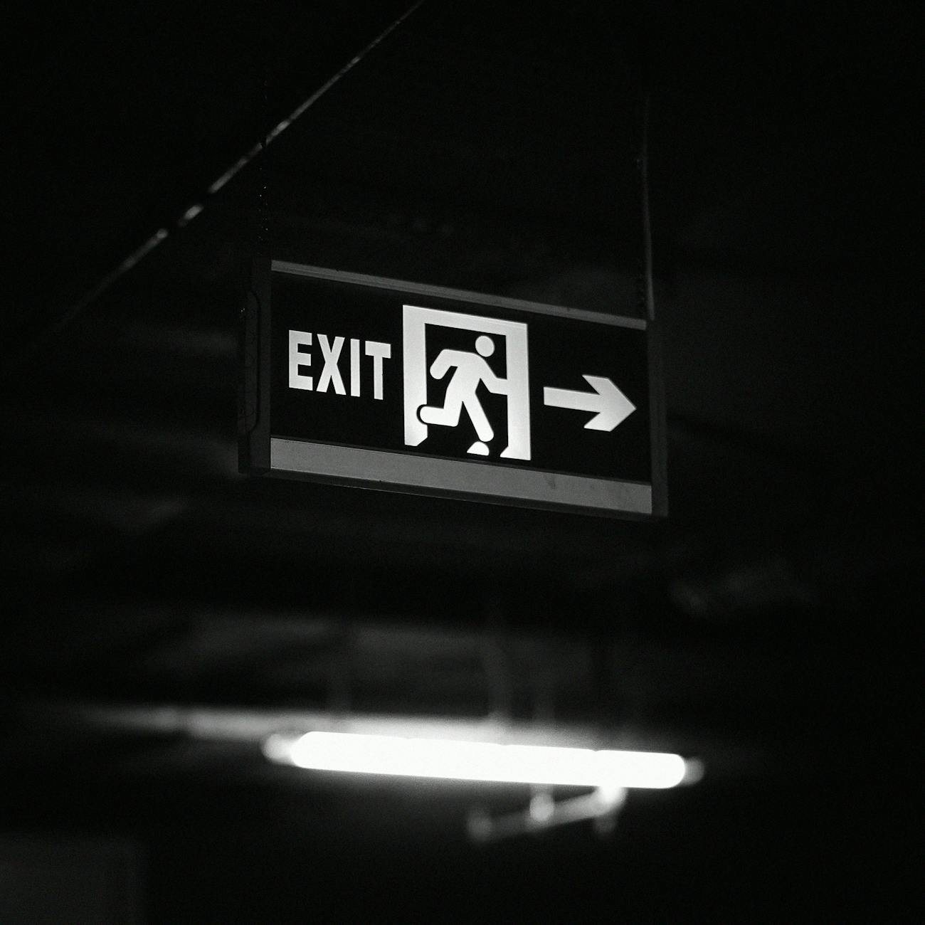
Signage Design #
Signage Design
Signage design involves the creation of visual communication elements, such as s… #
In wayfinding design, signage design is critical for guiding users through spaces, providing navigation cues, and enhancing the overall user experience.
Example #
Designing clear, intuitive signage for a shopping mall helps customers find stores, restrooms, and parking areas easily and navigate the mall efficiently.
T #
T
Touchscreen Technology</ #
Touchscreen Technology