Public Transportation and Mobility
Public Transportation refers to a system of shared passenger services that operate on fixed routes and schedules, typically funded by government agencies or public‑private partnerships. It includes modes such as buses, trams, subways, commu…
Public Transportation refers to a system of shared passenger services that operate on fixed routes and schedules, typically funded by government agencies or public‑private partnerships. It includes modes such as buses, trams, subways, commuter rail, and ferries. The primary objective is to move large numbers of people efficiently while reducing reliance on private automobiles. For example, a city’s bus network that connects residential neighborhoods to a central business district illustrates how mass movement can be achieved with relatively low per‑passenger energy consumption. A key challenge for public transportation systems is maintaining service quality in the face of fluctuating ridership, aging infrastructure, and limited fiscal resources.
Mobility is a broader concept that encompasses all means of moving people and goods, including walking, cycling, private cars, ride‑hailing, and emerging shared‑mobility services. In the context of sustainable transportation, mobility emphasizes the ability to travel conveniently, affordably, and with minimal environmental impact. A city that provides a dense network of sidewalks, protected bike lanes, and reliable bus service offers a high level of travel freedom to its residents. The challenge lies in integrating these diverse modes so that users can seamlessly transition from one mode to another without excessive time loss or cost.
Modal Share denotes the proportion of total trips made by each transportation mode within a given area. It is a critical indicator for policymakers because it reveals the effectiveness of strategies aimed at shifting trips from high‑emission modes to more sustainable alternatives. For instance, a city that achieves a 30 % share for public transit, 20 % for cycling, and 50 % for private cars has made progress toward reducing greenhouse‑gas emissions, but the remaining dominance of automobiles indicates room for further intervention. Accurate measurement of modal share requires comprehensive travel surveys and the integration of data from smart‑card systems, mobile apps, and traffic counters.
Mode Shift is the intentional movement of travelers from one mode to another, typically from private car use to public transit, cycling, or walking. Policies that encourage mode shift include congestion pricing, parking reforms, and investment in high‑quality non‑motorized infrastructure. A successful example is the implementation of a low‑emission zone that restricts vehicle entry to the historic city center, prompting commuters to switch to the metro or a bike‑share program. Challenges to achieving a durable mode shift involve addressing perceived convenience, safety concerns, and the “first‑ and last‑mile” barrier that can deter potential users.
First‑ and Last‑Mile refers to the distance between a person’s origin or destination and the nearest transit hub. Solving first‑ and last‑mile problems is essential for increasing transit ridership because even well‑designed high‑capacity services can be underutilized if access to stations is inconvenient. Solutions include feeder bus routes, shared micromobility devices, and pedestrian‑friendly street design. For example, a city that installs a network of dockless electric scooters near subway stations enables commuters to cover short distances quickly, thereby enhancing the overall attractiveness of the transit system. The main challenge is ensuring that these auxiliary services are safe, well‑maintained, and integrated with fare systems.
Transit‑Oriented Development (TOD) is an urban planning approach that concentrates mixed‑use, high‑density development within walking distance of high‑capacity transit stations. The goal is to create liveable neighborhoods where residents can meet most of their daily needs without relying on a car. A classic case is the redevelopment of an area around a new light‑rail stop into a mix of apartments, offices, retail, and public spaces, all designed to be pedestrian‑friendly. While TOD can dramatically increase transit ridership and reduce vehicle miles traveled, it also raises concerns about affordability, gentrification, and the need for coordinated zoning reforms.
Mobility‑as‑a‑Service (MaaS) is a digital platform that aggregates multiple transportation options—public transit, car‑sharing, bike‑share, ride‑hailing—into a single, user‑friendly interface. Users can plan, book, and pay for multimodal trips through a smartphone app, often with dynamic pricing that reflects real‑time conditions. An example is a city‑wide MaaS platform that offers a subscription package covering unlimited bus rides, discounted bike rentals, and a set number of ride‑hail trips per month. The promise of MaaS lies in its ability to simplify travel planning and encourage the use of lower‑impact modes. However, challenges include data sharing between private operators, ensuring equitable access for low‑income users, and protecting passenger privacy.
Bus Rapid Transit (BRT) is a high‑capacity bus system that incorporates features such as dedicated lanes, off‑board fare collection, and priority signaling to achieve speed and reliability comparable to light rail. In many developing cities, BRT provides a cost‑effective alternative to rail while delivering similar performance benefits. For instance, a BRT corridor with median‑aligned stations and limited stops can move passengers at speeds of 25 km/h, reducing travel time by up to 30 % compared with conventional bus services. The primary challenges for BRT include securing right‑of‑way, managing mixed traffic interactions, and maintaining the dedicated infrastructure over time.
Light Rail Transit (LRT) is a rail‑based system that typically operates at street level, often with a combination of exclusive right‑of‑way and mixed traffic segments. LRT vehicles are electrically powered, producing lower emissions per passenger‑kilometer than diesel buses. A successful LRT implementation might involve a 15‑km line connecting suburban neighborhoods to the downtown core, with stations spaced at 500‑meter intervals to balance speed and accessibility. The challenges for LRT include high capital costs, the need for extensive utility relocation, and potential community resistance to visual impacts.
Heavy Rail / Metro denotes high‑capacity, fully grade‑separated rail systems that run on exclusive tracks, often underground or on elevated structures. These systems can transport tens of thousands of passengers per hour per direction, making them essential for dense urban cores. An example is a metro line that serves a corridor with a daily ridership of 200 000 passengers, providing frequent service with headways of three minutes during peak periods. The major challenges for heavy rail include the enormous upfront investment, long construction timelines, and the necessity of sophisticated signaling and safety systems.
Tram / Streetcar systems operate on tracks embedded in city streets, sharing space with other vehicles and pedestrians. Modern trams are often low‑floor, energy‑efficient, and equipped with regenerative braking. A city that reintroduces a historic streetcar line as a tourist attraction while also serving local commuters illustrates the dual economic and mobility benefits of trams. However, trams can be vulnerable to traffic congestion unless they are granted dedicated lanes or signal priority, which may require significant changes to existing road layouts.
Commuter Rail provides regional service that links suburban or peri‑urban areas with central cities, typically using existing freight or passenger rail corridors. These services are characterized by longer distances between stops and higher speeds than urban light rail. For example, a commuter rail line that travels 60 km from a satellite town to the central business district, with stations spaced at 10‑km intervals, can attract drivers who would otherwise face congested highway commutes. Challenges include coordinating schedules with freight operators, ensuring station accessibility, and managing fare integration across multiple agencies.
Accessibility in transportation refers to the ease with which people can reach desired services, employment, education, and recreation using the available mobility options. It is often measured by the number of jobs reachable within a given travel time threshold. A city that improves bus frequency and adds new bike lanes may increase the accessibility index for low‑income neighborhoods, thereby supporting social equity goals. The main difficulty in assessing accessibility lies in capturing the diversity of user needs, including those of persons with disabilities, the elderly, and children.
Equity concerns the fair distribution of transportation benefits and burdens across different population groups. An equitable system ensures that low‑income households, minorities, and historically underserved communities have comparable access to reliable and affordable mobility. Policies such as reduced fare programs, targeted service improvements, and inclusive planning processes are tools to advance equity. A persistent challenge is balancing the need for cost recovery with the social imperative to provide universal service, especially when operating subsidies are limited.
Fare Integration describes the coordination of ticketing and pricing across multiple transport modes and operators, enabling passengers to travel on a single ticket or smart card without paying separate fares for each leg. Integrated fare systems simplify journeys, reduce transaction times, and can encourage multimodal trips. For instance, a regional transit authority that adopts a unified contactless card for buses, trams, and commuter rail eliminates the need for cash handling and reduces boarding delays. Technical obstacles include aligning fare structures, reconciling revenue sharing agreements, and upgrading legacy fare collection equipment.
Demand Management encompasses strategies designed to influence travel behavior, often by discouraging single‑occupancy vehicle trips during peak periods. Tools include congestion pricing, parking levies, telecommuting incentives, and flexible work hours. A successful demand‑management program might involve an electronic road‑pricing scheme that charges higher rates during rush hour, prompting commuters to shift travel to off‑peak times or use public transit. The principal challenges include political acceptability, ensuring that alternatives are available, and addressing potential regressive impacts on low‑income drivers.
Vehicle Occupancy measures the average number of passengers per vehicle, a key indicator of transport efficiency. Higher occupancy rates generally mean lower emissions per passenger‑kilometer. For example, a bus operating at an average occupancy of 30 % of its capacity is less efficient than one reaching 70 % during peak periods. Strategies to improve occupancy include express services, dynamic routing, and incentives for carpooling. However, achieving higher occupancy can be difficult due to peak‑off‑peak demand imbalances and the need for flexible scheduling.
Load Factor is a related concept that expresses the proportion of available seating that is actually occupied. It is commonly used in aviation and rail contexts, but also applies to buses and ferries. A load factor of 80 % indicates that most seats are filled, suggesting efficient resource utilization. Low load factors may signal overcapacity or poorly timed services, prompting operators to adjust frequencies or vehicle sizes. The challenge is to maintain a high load factor without sacrificing passenger comfort during crowded periods.
Service Frequency denotes how often a vehicle departs from a stop or station, usually expressed in vehicles per hour. Higher frequency reduces waiting times and improves the attractiveness of transit, especially for spontaneous trips. A bus line that runs every five minutes during peak hours offers a more reliable service than one with a 15‑minute interval. Planning appropriate frequencies requires balancing operational costs with expected demand, and may involve real‑time adjustments based on passenger counts.
Headway is the time interval between successive vehicles on the same route. Short headways are crucial for high‑capacity corridors and for minimizing passenger crowding. For example, a light‑rail line that maintains a 2‑minute headway during rush hour can transport large numbers of passengers without long queues. Reducing headways often necessitates advanced signaling, precise vehicle control, and robust communication systems. The principal difficulty lies in coordinating driver schedules, vehicle availability, and maintenance windows.
Schedule Reliability reflects the degree to which a transit service adheres to its published timetable. Reliable schedules increase passenger confidence and can boost ridership. A bus route that consistently arrives within two minutes of its scheduled time is considered highly reliable. Factors that undermine reliability include traffic congestion, roadworks, and variable passenger boarding times. Implementing transit signal priority, dedicated lanes, and real‑time monitoring can mitigate these issues, though they require investment and coordination with municipal traffic authorities.
On‑Time Performance is a specific metric that quantifies the percentage of trips that arrive at a stop within a defined time window of the scheduled arrival. It is often used as a key performance indicator (KPI) for transit agencies. For instance, an on‑time performance target of 90 % for a subway line means that nine out of ten trains must meet the timing criteria. Persistent under‑performance may trigger service adjustments, staff training, or infrastructure upgrades. The challenge is to maintain high on‑time performance while coping with external disruptions such as extreme weather events.
Park‑and‑Ride facilities are parking lots located near transit stations that allow commuters to drive part of their journey and then transfer to public transit for the remainder. These facilities can expand the catchment area of a rail or bus line, reducing the need for extensive downtown parking. An example is a suburban commuter rail station equipped with a 500‑space park‑and‑ride lot, which captures drivers from surrounding neighborhoods. Challenges include managing land use efficiently, setting appropriate parking fees, and ensuring that the added car trips do not generate congestion on access roads.
Kiss‑and‑Ride zones are designated areas at transit stations where passengers can be dropped off or picked up by private vehicles. They facilitate quick transfers for those who are being driven to the station, often for short‑distance trips. A well‑designed kiss‑and‑ride lane minimizes interference with through traffic and can improve overall station accessibility. However, if not properly managed, such zones can become bottlenecks and increase congestion around the station precinct.
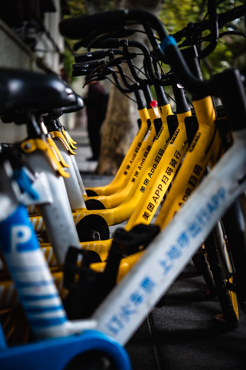
Shared Mobility encompasses a range of services that provide on‑demand access to vehicles without ownership, including car‑sharing, bike‑sharing, scooter‑sharing, and ride‑hailing. These services can complement public transit by filling gaps in the first‑ and last‑mile network. For example, a city that offers a dockless bike‑share program near transit hubs enables commuters to combine cycling with train travel, reducing reliance on cars. The main challenges involve regulating fleet sizes, ensuring vehicle distribution equity, and integrating payment systems with existing transit fare structures.
Ride‑Hailing platforms such as Uber or Lyft provide door‑to‑door transportation through a mobile application, matching passengers with drivers in real time. While ride‑hailing can increase mobility for underserved areas, it may also generate additional vehicle miles traveled if trips replace existing public transit rides. Studies have shown that in some cities, ride‑hailing has contributed to traffic congestion and increased emissions. Effective policy responses include imposing congestion charges, limiting service zones, or encouraging the use of electric vehicles within the ride‑hailing fleet.
Microtransit describes flexible, demand‑responsive services that operate with smaller vehicles and dynamic routing, often using a smartphone app to request rides. These services bridge the gap between fixed‑route transit and private car use, especially in low‑density neighborhoods where traditional bus service is not cost‑effective. An example is a community‑based microtransit program that provides on‑demand shuttles during off‑peak hours, improving access for seniors. Challenges include achieving economies of scale, maintaining service reliability, and integrating microtransit with broader network planning.
Transit Signal Priority (TSP) is a technology that allows approaching transit vehicles to request extended green phases at traffic signals, reducing stop times and improving schedule adherence. TSP can be implemented through GPS‑based detection or vehicle‑to‑infrastructure communication. A corridor equipped with TSP may see bus travel times reduced by 10‑15 % during peak periods. The main difficulties involve coordinating with municipal traffic management, ensuring that priority does not overly disrupt cross‑traffic, and maintaining the technology’s reliability.
Dynamic Routing involves adjusting vehicle paths in real time based on traffic conditions, passenger demand, or operational constraints. This concept is central to on‑demand services and some advanced bus operations. For example, a bus equipped with a dynamic routing algorithm may deviate from its fixed route to pick up passengers who have requested a stop via a mobile app, provided the deviation does not cause excessive delays. Implementing dynamic routing requires sophisticated data analytics, robust communication networks, and clear policies on service guarantees.
Complete Streets is a design philosophy that aims to create roadways safe and accessible for all users—pedestrians, cyclists, transit riders, and motorists. The approach emphasizes features such as wide sidewalks, protected bike lanes, well‑marked crosswalks, and bus‑only lanes. A city that redesigns a major arterial into a complete street may see increased walking and cycling rates, reduced crash severity, and higher transit ridership. However, retrofitting existing streets can be costly, and stakeholders may resist changes that appear to reduce vehicle capacity.
Active Transportation refers to modes of travel that involve physical activity, primarily walking and cycling. Promoting active transportation contributes to public health, reduces emissions, and eases congestion. Infrastructure such as continuous bike lanes, pedestrian plazas, and traffic calming measures supports active transportation. A challenge is ensuring that these facilities are safe, well‑maintained, and connected to key destinations, especially in areas where car dominance has historically limited non‑motorized travel.
Smart Card technology enables contactless fare payment across multiple transit modes, streamlining boarding and reducing cash handling. Smart cards can store fare balances, pass products, and concession entitlements, and they often support automated fare collection at gates or on‑board validators. An example is a citywide smart‑card system that allows passengers to tap on a bus and then transfer to a subway without paying an additional fare, encouraging seamless multimodal journeys. The main challenges involve the upfront cost of card issuance, system integration across agencies, and protecting user data privacy.
Farebox Recovery Ratio is the proportion of operating expenses that is covered by passenger fares. A higher ratio indicates greater financial sustainability, but an excessively high ratio may suggest that fares are set too high, potentially discouraging ridership. For instance, a transit agency with a farebox recovery ratio of 45 % relies on subsidies for the remaining 55 % of operating costs. Balancing fare levels with service quality, social equity, and budget constraints remains a persistent policy dilemma.
Operating Subsidy denotes the financial support provided by governments or other entities to cover the gap between operating costs and fare revenue. Subsidies are essential for maintaining service levels, especially on routes that are socially necessary but not financially profitable. An example is a municipal subsidy that funds night‑time bus service in low‑density neighborhoods, ensuring that residents have access to essential services after regular working hours. The challenge lies in allocating limited subsidy funds transparently and efficiently while meeting equity objectives.
Public‑Private Partnership (PPP) is a contractual arrangement where private sector entities collaborate with public agencies to finance, design, build, operate, or maintain transportation infrastructure. PPPs can leverage private capital and expertise, potentially accelerating project delivery. A notable case is a light‑rail line built under a design‑build‑finance‑operate (DBFO) model, where the private partner recovers its investment through availability payments over a 30‑year period. Risks include ensuring that public interests are protected, that performance standards are met, and that long‑term costs do not outweigh the benefits.
Funding Mechanisms encompass the various sources of financial support for transportation projects, including taxes, user fees, bonds, and grants. Common mechanisms include gasoline excise taxes, vehicle registration fees, congestion charges, and dedicated sales‑tax districts. For example, a regional transit authority may issue general‑obligation bonds to fund a new commuter rail line, repaying the debt through a combination of fare revenue and local tax increments. Effective funding strategies must balance revenue stability, political feasibility, and the need to internalize external costs.
Capital Investment refers to the expenditure on long‑term assets such as vehicles, stations, tracks, and signaling equipment. Capital projects are typically financed through bonds, grants, or dedicated tax revenues, and they have a lifespan measured in decades. A large‑scale capital investment might involve constructing a new subway tunnel that costs several billion dollars but dramatically expands network capacity. The challenge is to prioritize projects based on rigorous cost‑benefit analysis while managing construction impacts on existing communities.
Operating Cost includes all expenses required to run a transit service on a day‑to‑day basis, such as labor, fuel, maintenance, and administrative overhead. Controlling operating costs is essential for financial sustainability, especially when farebox recovery is low. Strategies for cost reduction include adopting energy‑efficient vehicles, optimizing schedules, and employing predictive maintenance technologies. However, cutting costs must not compromise safety, service quality, or accessibility.
Cost‑Benefit Analysis (CBA) is an economic tool that compares the projected benefits of a project—such as reduced travel time, lower emissions, and increased employment—against its costs, including construction, operation, and environmental impacts. A CBA may reveal that a new BRT corridor yields a benefit‑cost ratio of 1.8, Indicating that every dollar invested generates $1.80 In societal benefits. Conducting a robust CBA requires reliable data, appropriate valuation of non‑market impacts, and transparent assumptions. Misestimation can lead to suboptimal investment decisions.
Externalities are costs or benefits that affect third parties who are not directly involved in a transaction. In transportation, negative externalities include air pollution, noise, congestion, and accidents, while positive externalities might involve reduced traffic due to a new transit line. Accounting for externalities often involves assigning monetary values to health impacts or time lost in congestion, thereby informing policy choices such as congestion pricing. The difficulty lies in accurately quantifying these effects and integrating them into decision‑making frameworks.
Social Cost represents the total cost to society of a particular activity, encompassing both private costs and externalities. For transportation, the social cost of a car trip includes fuel expenses, wear‑and‑tear, emissions, and the value of added congestion. By contrast, the social cost of a bus trip is lower per passenger when occupancy is high. Policies that internalize social costs—such as carbon pricing or congestion fees—aim to shift behavior toward more sustainable modes. A challenge is ensuring that cost internalization does not disproportionately burden low‑income households.
Life‑Cycle Assessment (LCA) is a methodological framework for evaluating the environmental impacts of a product or service throughout its entire life cycle, from raw‑material extraction to disposal. In transportation, LCA can compare the total greenhouse‑gas emissions of diesel buses, electric buses, and hydrogen‑fuel‑cell buses over their operational lifespan. An LCA might reveal that, despite higher upfront emissions for battery production, electric buses achieve a lower overall carbon footprint after a certain mileage threshold. Conducting comprehensive LCAs requires reliable data on manufacturing processes, energy sources, and end‑of‑life recycling.
Energy Intensity measures the amount of energy consumed per passenger‑kilometer or per vehicle‑kilometer. Lower energy intensity indicates a more efficient mode of travel. For instance, a light‑rail vehicle may have an energy intensity of 0.5 MJ per passenger‑kilometer, whereas a private gasoline car might consume 2 MJ per passenger‑kilometer under average occupancy. Reducing energy intensity can be achieved through vehicle electrification, regenerative braking, and operational strategies such as optimal speed profiles. The challenge is to balance energy savings with passenger comfort and service reliability.
Vehicle Miles Traveled (VMT) is a metric that quantifies the total distance traveled by all vehicles within a region over a given period, typically expressed in millions of miles per year. VMT is used as an indicator of traffic volume, congestion, and associated emissions. Policies aimed at reducing VMT—such as telecommuting programs, congestion pricing, or improved transit service—seek to lower overall environmental impacts. Accurate VMT measurement relies on traffic counters, GPS data, and travel surveys, each with its own limitations.
Passenger Miles Traveled (PMT) tracks the cumulative distance traveled by passengers across all modes, providing insight into the level of mobility provided by the transportation system. A high PMT per capita can indicate a well‑connected network, while low PMT may signal underutilization of public transit. Comparing PMT to VMT can reveal the modal efficiency of a region; a higher ratio of PMT to VMT suggests that more trips are being made collectively rather than individually by cars. Collecting reliable PMT data often involves smart‑card tap‑on/tap‑off records and survey data.
Capacity refers to the maximum number of passengers that a vehicle, line, or corridor can accommodate within a given time period. Capacity is constrained by vehicle size, frequency, and infrastructure design. For example, a subway line with a capacity of 30 000 passengers per hour per direction can support high‑density urban travel without severe crowding. When demand exceeds capacity, operators may need to increase frequency, procure larger vehicles, or implement demand‑management measures. Over‑designing capacity, however, can lead to underutilized assets and wasted public funds.
Peak Period denotes the time intervals during the day when travel demand is highest, typically corresponding to morning and evening commutes. Transit agencies schedule higher frequencies and allocate additional vehicles to meet peak‑period demand. A peak‑period headway of two minutes on a busy bus corridor ensures that passengers experience short waiting times. Managing peak loads is challenging because it often requires substantial resource allocation, and peak demand can be exacerbated by school schedules, event traffic, or special occasions.
Off‑Peak refers to times when travel demand is lower, such as midday, late evenings, and weekends. Off‑peak periods provide opportunities for cost savings through reduced service frequencies, dynamic pricing, or the deployment of smaller vehicles. Some transit agencies introduce off‑peak discounts to encourage travel outside the congested morning and evening windows, thereby flattening the demand curve. The difficulty lies in maintaining sufficient service quality to remain attractive even when ridership is low.
Network Connectivity describes how well different parts of a transportation system are linked, allowing passengers to move between origins and destinations with minimal transfers or detours. High connectivity reduces travel time and improves the overall utility of the network. For instance, a well‑connected rail network may enable a passenger to travel from a suburban town to a downtown office with only one transfer, whereas a poorly connected system might require multiple changes and longer travel times. Enhancing connectivity often involves adding new links, improving transfer facilities, and integrating fare systems.
Transfer Penalty is an implicit cost assigned to each change of vehicle or mode in travel‑time calculations, reflecting the inconvenience, additional waiting, and possible fare surcharge associated with transfers. Planners use transfer penalties in travel‑demand models to predict mode choice and route selection. A high transfer penalty may discourage passengers from using multimodal trips, even if the overall travel time is shorter. Reducing transfer penalties through coordinated schedules, synchronized real‑time information, and fare integration can make multimodal travel more attractive.
Demand‑Responsive Transit (DRT) offers flexible routing and scheduling based on real‑time passenger requests, often using smaller vehicles and digital platforms. DRT can serve low‑density areas where fixed‑route service is not cost‑effective. An example is a community‑run shuttle that passengers can book via an app, with the vehicle adjusting its route to pick up and drop off riders along the way. The challenges for DRT include maintaining acceptable waiting times, ensuring accessibility for persons with disabilities, and integrating the service with the broader transit network.
Transit Ridership measures the number of boardings on public‑transport vehicles over a specific period, providing a key performance indicator for agencies. Tracking ridership trends helps identify growth areas, evaluate service changes, and justify funding requests. For example, a 10 % increase in bus ridership after implementing a new express service suggests that the investment was successful. Ridership can be affected by service quality, fare policy, economic conditions, and competing modes, making it a complex metric to interpret.
Service Area defines the geographic region within which a transit agency provides regular service. Expanding the service area can increase accessibility but also raises operational costs and may dilute service frequency if resources are spread too thin. A regional transit authority might extend its service area to include neighboring suburbs, thereby attracting new riders while also facing the challenge of maintaining reliable schedules across a larger network.
Mobility Hub is a strategically located facility that co‑locates multiple transportation services—such as bus bays, bike‑share docks, car‑share parking, and ride‑hail pick‑up zones—along with amenities like retail and public spaces. Mobility hubs aim to streamline transfers, reduce travel friction, and encourage multimodal journeys. A well‑designed hub may feature real‑time information displays, sheltered waiting areas, and secure bicycle storage, enhancing the overall user experience. Planning hubs requires coordination among various operators, land‑use considerations, and funding for infrastructure improvements.
Integrated Ticketing enables passengers to purchase a single ticket that grants access to multiple transportation modes, often through a unified payment platform. This reduces the need for multiple fare media and simplifies travel planning. For instance, a traveler could use a mobile app to buy a day pass that covers buses, trams, and commuter rail, eliminating the need to buy separate tickets at each mode’s point of sale. Technical obstacles include aligning fare structures, reconciling revenue sharing, and ensuring system interoperability across different agencies.
Zero‑Emission Bus refers to a bus powered by electricity, hydrogen fuel cells, or other technologies that produce no tailpipe emissions. Deploying zero‑emission buses can significantly lower urban air pollution and greenhouse‑gas emissions, especially when the electricity originates from renewable sources. A city may replace a portion of its diesel fleet with battery‑electric buses, achieving a reduction in CO₂ emissions of several thousand tonnes per year. Challenges include higher upfront vehicle costs, the need for charging or refueling infrastructure, and managing battery degradation over the vehicle’s lifespan.
Electric Bus specifically uses an onboard battery charged from the electrical grid. Advances in battery technology have extended range and reduced charging times, making electric buses viable for many urban routes. For example, a 12‑meter electric bus with a 300‑kilometre range can complete a full day of service on a single charge, provided that charging stations are strategically placed at depots or end‑of‑line terminals. The primary challenges involve securing sufficient grid capacity, optimizing charging schedules, and addressing concerns about battery lifespan and recycling.
Hydrogen Fuel‑Cell Bus generates electricity through a chemical reaction between hydrogen and oxygen, producing only water vapor as an exhaust. Fuel‑cell buses can achieve longer ranges and faster refueling compared with battery‑electric buses, making them attractive for routes with high utilization or limited charging infrastructure. A pilot program might deploy a fleet of hydrogen buses on a suburban corridor, demonstrating reduced emissions and comparable performance to diesel counterparts. However, the high cost of hydrogen production, storage, and limited refueling stations pose significant barriers to widespread adoption.
Autonomous Vehicles (AVs) are capable of operating without a human driver, using sensors, artificial intelligence, and communication technologies. In the public‑transport context, autonomous shuttles can provide on‑demand service within campuses, airports, or low‑density neighborhoods. An autonomous shuttle that circulates a university campus can reduce the need for private car trips and improve safety by eliminating driver error. Regulatory uncertainty, public acceptance, cybersecurity risks, and the need for robust infrastructure are major challenges that must be addressed before AVs can be fully integrated into public‑transport networks.
Mobility Management encompasses a suite of policies and programs that aim to improve the efficiency, equity, and sustainability of travel. These may include travel‑plan counseling, employer‑based commuting incentives, and the promotion of active travel. A city’s mobility‑management office might work with large employers to develop a “green commute” program that offers subsidized transit passes, secure bike storage, and flexible work hours. The difficulty lies in coordinating across multiple stakeholders, measuring program outcomes, and scaling successful initiatives.
Travel Behaviour studies the decision‑making processes that determine how individuals choose travel modes, routes, departure times, and trip purposes. Understanding travel behaviour is essential for designing effective interventions, such as pricing schemes or service improvements. Surveys, focus groups, and data from mobile devices can reveal factors like perceived convenience, cost, and social norms that influence mode choice. Translating behavioural insights into policy can be challenging due to the complexity of human preferences and the need for long‑term monitoring.
Travel Demand Modeling uses mathematical and simulation techniques to forecast future travel patterns based on land‑use changes, demographic trends, and transportation policies. Models such as the four‑step model (trip generation, trip distribution, mode choice, route assignment) or activity‑based models help planners evaluate the impacts of new projects.
Key takeaways
- For example, a city’s bus network that connects residential neighborhoods to a central business district illustrates how mass movement can be achieved with relatively low per‑passenger energy consumption.
- Mobility is a broader concept that encompasses all means of moving people and goods, including walking, cycling, private cars, ride‑hailing, and emerging shared‑mobility services.
- It is a critical indicator for policymakers because it reveals the effectiveness of strategies aimed at shifting trips from high‑emission modes to more sustainable alternatives.
- A successful example is the implementation of a low‑emission zone that restricts vehicle entry to the historic city center, prompting commuters to switch to the metro or a bike‑share program.
- For example, a city that installs a network of dockless electric scooters near subway stations enables commuters to cover short distances quickly, thereby enhancing the overall attractiveness of the transit system.
- While TOD can dramatically increase transit ridership and reduce vehicle miles traveled, it also raises concerns about affordability, gentrification, and the need for coordinated zoning reforms.
- Mobility‑as‑a‑Service (MaaS) is a digital platform that aggregates multiple transportation options—public transit, car‑sharing, bike‑share, ride‑hailing—into a single, user‑friendly interface.